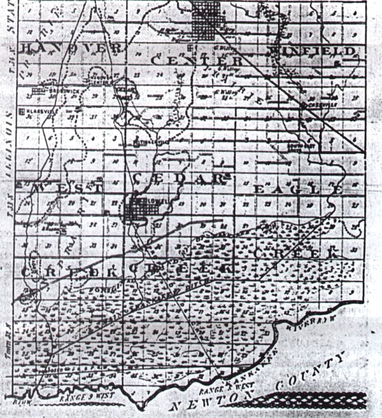
This 1876 map of south Lake County shows the main roads that existed then. The original bounday of the Kankakee Marsh is shown very close to Belshaw Road. Many roads dead-ended because there were no bridges over streams and ponds, including what is now State Road 55 to Shelby. The body of water on Lowell's north boundary is the Old Mill Pond.